DiuMitra Online Learning Centre

UK Road Signs Quiz: Free Visual Practice

Take this UK road signs quiz to practise recognising common British traffic signs. Answer ten original, illustrated questions, check each explanation and learn the difference between signs that give orders, warn of danger or provide information. Use the current Highway Code to confirm any rule before driving.

Independent DiuMitra revision for England, Scotland and Wales. Not an official DVSA examination or substitute for the current Highway Code.
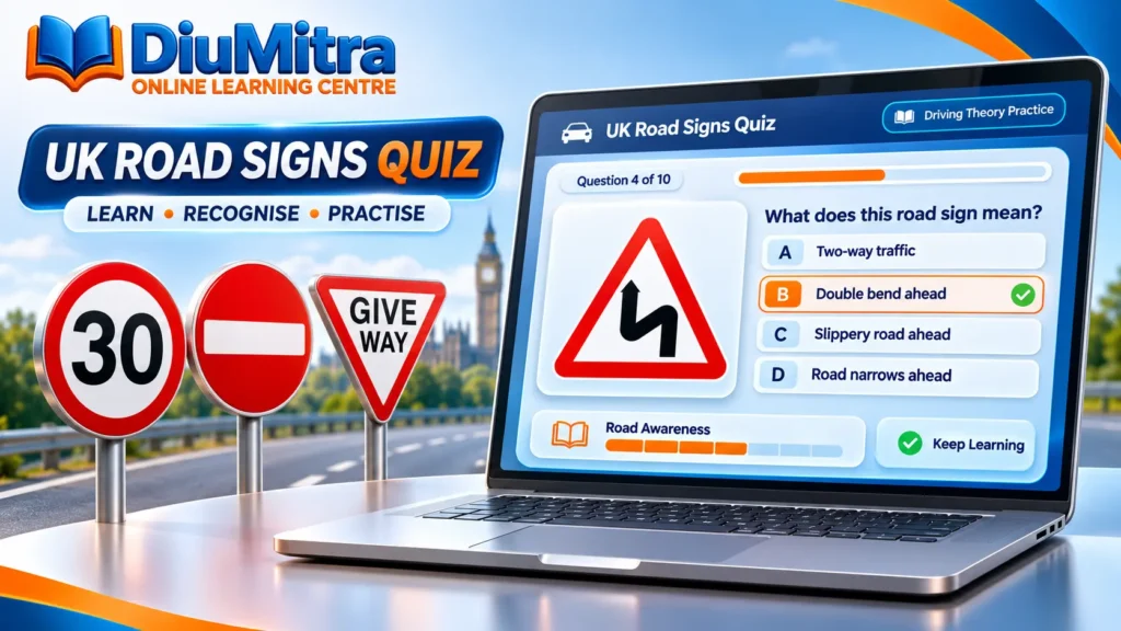
UK road signs quiz illustration showing a laptop with visual practice questions and British speed limit, No Entry and Give Way signs.
Play and learn

Start the Free UK Road Signs Quiz

Begin with ten illustrated road-sign questions. Select the meaning you think is correct, read the explanation, then move to the next sign. Your answers stay in this browser session; the short practice does not ask for an account.

VISUAL SIGN RECOGNITION10 original questions
Loading road sign practice…

What does this sign mean?

If the quiz does not load, please use the official Highway Code traffic signs guide or explore the DiuMitra visual sign library below.

Learn the sign system

How to Read UK Road Signs

The UK signing system groups signs by the job they do: giving orders, warning of hazards or supplying information. Understanding the basic shapes makes it easier to interpret unfamiliar signs.

Circles give orders

Red rings usually indicate a restriction or prohibition. Blue circles generally give a positive instruction, such as going ahead only or using a specified route.

Triangles warn

Red-bordered triangular signs generally alert you to hazards such as traffic signals, bends or junctions. Look at the symbol and respond to conditions safely.

Rectangles inform

Rectangular signs commonly give information or directions. Colours can also matter: motorway directions use blue signs, and primary routes use green.

Extended practice

More Road Signs, Signals and Markings

After the ten-question starter, explore the DiuMitra visual sign library and any available topic assessment. The independent starter above remains usable even when the extended reference collection is unavailable.

FREE ROAD SIGNS

Road Signs, Signals & Markings

Learn from governed Highway Code visual assets, then use visual self-check and the full topic assessment.
Complete official reference

FREE REFERENCE

The Highway Code

England, Scotland and Wales · governed DiuMitra reference copy

Reference HC-2026.10.21-005

Traffic signs

Although The Highway Code shows many of the signs commonly in use, a comprehensive explanation of our signing system is given in the Department’s booklet Know Your Traffic Signs, which is on sale at booksellers. The booklet also illustrates and explains the vast majority of signs the road user is likely to encounter.

The signs illustrated in The Highway Code are not all drawn to the same scale. In Wales, bilingual versions of some signs are used including Welsh and English versions of place names. Some older designs of signs may still be seen on the roads.

Signs giving orders

Signs with red circles are mostly prohibitive. Plates below signs qualify their message.

Entry to 20 mph zone

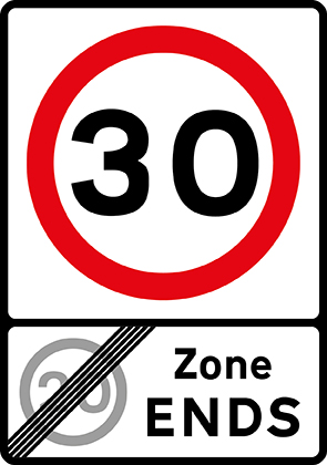
End of 20 mph zone

Maximum speed

National speed limit applies

School crossing patrol

Stop and give way

Give way to traffic on major road

Manually operated temporary STOP and GO signs

Manually operated temporary STOP and GO signs

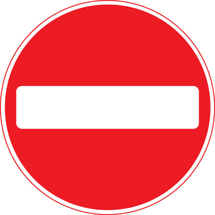
No entry for vehicular traffic

No vehicles except bicycles being pushed

No cycling

No motor vehicles

No buses (over 8 passenger seats)

No overtaking

No towed caravans

No vehicles carrying explosives

No vehicle or combination of vehicles over length shown

No vehicles over height shown

No vehicles over width shown

Give priority to vehicles from opposite direction

No right turn

No left turn

No U-turns

No goods vehicles over maximum gross weight shown (in tonnes) except for loading and unloading

No vehicles over maximum gross weight shown (in tonnes)

Parking restricted to permit holders

No stopping during period indicated except for buses

No stopping during times shown except for as long as necessary to set down or pick up passengers

No waiting

No stopping (Clearway)

Signs with blue circles but no red border mostly give positive instruction.

Ahead only

Turn left ahead (right if symbol reversed)

Turn left (right if symbol reversed)

Keep left (right if symbol reversed)

Vehicles may pass either side to reach same destination

Mini-roundabout (roundabout circulation - give way to vehicles from the immediate right)

Route to be used by pedal cycles only

Segregated pedal cycle and pedestrian route

Minimum speed

End of minimum speed

Buses and cycles only

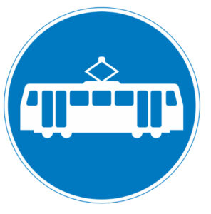
Trams only

Pedestrian crossing point over tramway

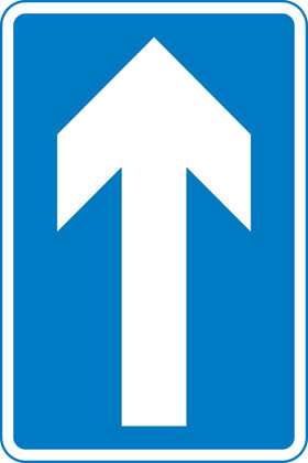
One-way traffic (note: compare circular ‘Ahead only’ sign)

With-flow bus and cycle lane

Contra-flow bus lane

With-flow pedal cycle lane

Warning signs

Mostly triangular

Distance to ‘STOP’ line ahead

Dual carriageway ends

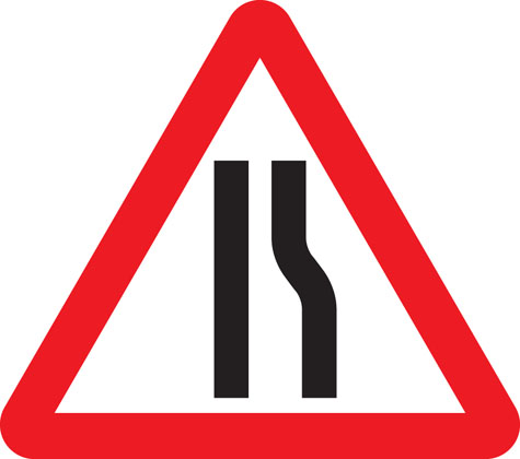
Road narrows on right (left if symbol reversed)

Road narrows on both sides

Distance to ‘Give Way’ line ahead

Crossroads

Junction on bend ahead

T-junction with priority over vehicles from the right

Staggered junction

Traffic merging from left ahead

The priority through route is indicated by the broader line.

Double bend first to left (symbol may be reversed)

Bend to right (or left if symbol reversed)

Roundabout

Uneven road

Plate below some signs

Two-way traffic crosses one-way road

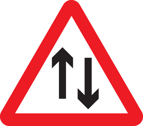
Two-way traffic straight ahead

Opening or swing bridge ahead

Low-flying aircraft or sudden aircraft noise

Falling or fallen rocks

Traffic signals not in use

Traffic signals

Slippery road

Steep hill downwards

Steep hill upwards

Gradients may be shown as a ratio i.e. 20% = 1:5

Tunnel ahead

Trams crossing ahead

Level crossing with barrier or gate ahead

Level crossing without barrier or gate ahead

Level crossing without barrier

School crossing patrol ahead (some signs have amber lights which flash when crossings are in use)

Frail (or blind or disabled if shown) pedestrians likely to cross road ahead

Pedestrians in road ahead

Zebra crossing

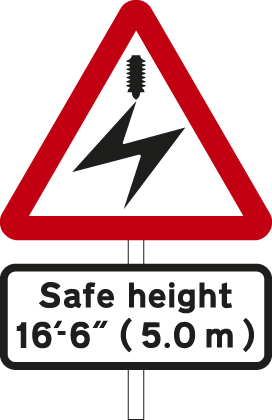
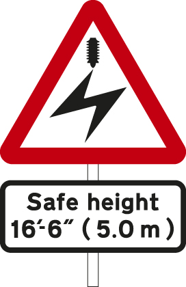
Overhead electric cable; plate indicates maximum height of vehicles which can pass safely

Available width of headroom indicated

Sharp deviation of route to left (or right if chevrons reversed)

Light signals ahead at level crossing, airfield or bridge

Miniature warning lights at level crossings

Cattle

Wild animals

Wild horses or ponies

Accompanied horses or ponies

Cycle route ahead

Risk of ice

Traffic queues likely ahead

Distance over which road humps extend

Other danger; plate indicates nature of danger

Soft verges

Side winds

Hump bridge

Worded warning sign

Quayside or river bank

Risk of grounding

Direction signs

Mostly rectangular

Signs on motorways - blue backgrounds

At a junction leading directly into a motorway (junction number may be shown on a black background)

On approaches to junctions (junction number on black background)

Route confirmatory sign after junction

Downward pointing arrows mean ‘Get in lane’ The left-hand lane leads to a different destination from the other lanes.

The panel with the inclined arrow indicates the destinations which can be reached by leaving the motorway at the next junction

Signs on primary routes - green backgrounds

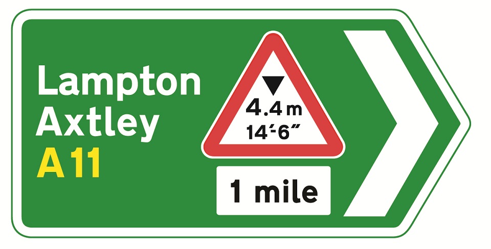
Blue panels indicate that the motorway starts at the junction ahead. Motorways shown in brackets can also be reached along the route indicated. White panels indicate local or non-primary routes leading from the junction ahead. Brown panels show the route to tourist attractions. The name of the junction may be shown at the top of the sign. The aircraft symbol indicates the route to an airport. A symbol may be included to warn of a hazard or restriction along that route.

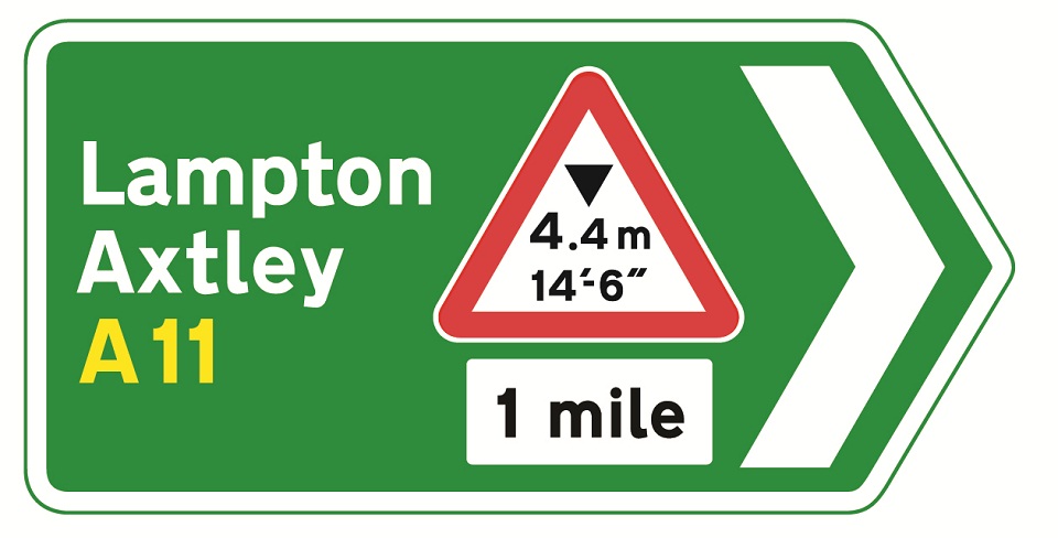
On approaches to junctions

At the junction

Route confirmatory sign after junction

On approaches to junctions

On approach to a junction in Wales (bilingual)

Primary route forming part of a ring road

Primary route forming part of a ring road

Signs on non-primary and local routes - black borders

Green panels indicate that the primary route starts at the junction ahead. Route numbers on a blue background show the direction to a motorway. Route numbers on a green background show the direction to a primary route.

On approaches to junctions

On approaches to junctions

At the junction

Direction to toilets with access for the disabled

Other direction signs

Picnic site

Ancient monument in the care of English Heritage

Direction to a car park

Tourist attraction

Direction to camping and caravan site

Advisory route for lorries

Route for pedal cycles forming part of a network

Recommended route for pedal cycles to place shown

Route for pedestrians

Symbols showing emergency diversion route for motorway and other main road traffic

Symbols showing emergency diversion route for motorway and other main road traffic

Symbols showing emergency diversion route for motorway and other main road traffic

Symbols showing emergency diversion route for motorway and other main road traffic

Diversion route

Information signs

All rectangular

Entrance to controlled parking zone

Entrance to congestion charging zone

End of controlled parking zone

Advance warning of restriction or prohibition ahead

Parking place for solo motorcycles

With-flow bus lane ahead which pedal cycles and taxis may also use

Lane designated for use by high occupancy vehicles (HOV) - see rule 142

Vehicles permitted to use an HOV lane ahead

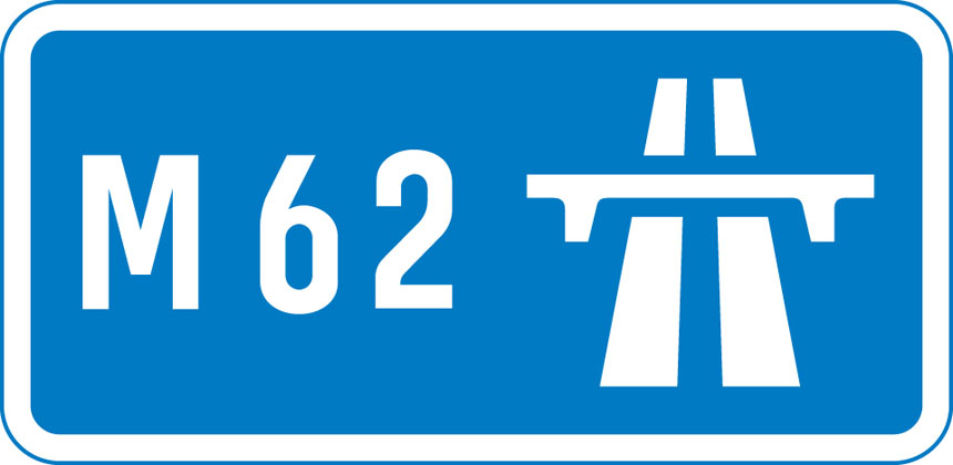
End of motorway

Start of motorway and point from which motorway regulations apply

Appropriate traffic lanes at junction ahead

Traffic on the main carriageway coming from right has priority over joining traffic

Additional traffic joining from left ahead. Traffic on main carriageway has priority over joining traffic from right hand lane of slip road

Traffic in right hand lane of slip road joining the main carriageway has priority over left hand lane

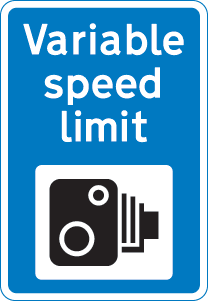
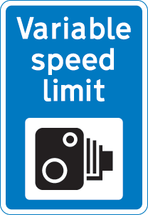
Variable speed limit with camera enforcement sign.

‘Countdown’ markers at exit from motorway (each bar represents 100 yards to the exit). Green-backed markers may be used on primary routes and white-backed markers with black bars on other routes. At approaches to concealed level crossings white-backed markers with red bars may be used. Although these will be erected at equal distances the bars do not represent 100 yard intervals.

Motorway service area sign showing the operator’s name

Traffic has priority over oncoming vehicles

Hospital ahead with Accident and Emergency facilities

Tourist information point

No through road for vehicles

Recommended route for pedal cycles

Home Zone Entry

Area in which cameras are used to enforce traffic regulations

Bus lane on road at junction ahead

Road work signs

Road works

Loose chippings

Temporary hazard at road works

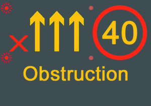
Temporary lane closure (the number and position of arrows and red bars may be varied according to lanes open and closed)

Slow-moving or stationary works vehicle blocking a traffic lane. Pass in the direction shown by the arrow.

Mandatory speed limit ahead

Road works 1 mile ahead

End of road works and any temporary restrictions including speed limits

Signs used on the back of slow-moving or stationary vehicles warning of a lane closed ahead by a works vehicle. There are no cones on the road.

Signs used on the back of slow-moving or stationary vehicles warning of a lane closed ahead by a works vehicle. There are no cones on the road.

Lane restrictions at road works ahead

One lane crossover at contraflow road works
Contains public sector information licensed under the Open Government Licence v3.0 where applicable. Source: Department for Transport, The Highway Code. DiuMitra is not affiliated with or endorsed by DVSA or the Department for Transport.

Road signs topic test

Road and traffic signs — Topic Practice

20 questions 75% pass mark 25 minutes

If the extended sign collection is unavailable, continue with the official Highway Code traffic signs reference while the learning catalogue is updated.

Look more closely

Road Signs People Commonly Confuse

Several signs can appear similar at first glance. In the quiz, read the shape, colour, symbol and any words or plates rather than guessing from one feature.

No waiting vs no stopping

The red diagonal line through a blue circle means no waiting; a red X means no stopping. Check nearby plates and road markings for the full restriction.

Ahead only vs one way

A white upward arrow inside a blue circle gives an ahead-only instruction. The arrow inside a blue rectangle indicates one-way traffic.

No entry vs give way

No Entry restricts vehicular entry. Give Way means approaching traffic on the major road has priority; you may need to stop before proceeding.

Three useful steps

How to Practise Road Signs Effectively

Try a short focused session, understand mistakes immediately and return to official sources. DiuMitra’s starter activity does not grade your readiness for the real driving theory test.

1

Look at the whole sign

Notice whether the sign is circular, triangular or rectangular. Check the symbol, numbers and any additional text beneath it.

2

Choose the best meaning

Select one answer without looking it up first. The activity shows an explanation and identifies the correct answer after you choose.

3

Review and repeat

Use the Highway Code when uncertain, especially for restrictions and exceptions. Repeat the quiz to check whether the explanations make sense.

A useful comparison

UK Road Sign Categories at a Glance

Signs work together with road markings, signals and supplementary plates. This overview helps you decide which official section to study next.

Type of signWhat it generally tells youTypical examples
Regulatory / order signsWhat you must do, or what you must not doSTOP, Give Way, No Entry, maximum speed, Ahead Only
Warning signsHazards or road conditions to anticipateTraffic signals ahead, bends, junctions
Direction and information signsRoutes, destinations, road layout or facilitiesOne-way traffic, direction boards, motorway information
Supplementary platesExtra details that qualify a main signTimes, distances, vehicle restrictions
Road markings and signalsAdditional instructions or information on the roadStop lines, lane arrows, traffic lights
Check the rules

Official UK Road Signs and Revision Resources

This quiz uses original schematic sign drawings and independently written explanations based on published traffic-sign guidance. Signs, restrictions and test arrangements can change, so the official guidance remains the source for current requirements.

For road users refreshing their knowledge

Use the quiz to recognise sign meanings, then check official explanations. Never assume an image alone gives every detail of a road restriction; signs may be paired with plates, road markings or location-specific arrangements.

Northern Ireland has its own official arrangements and some differences. Follow the relevant local authority guidance.

Helpful answers

UK Road Signs Quiz FAQs

Clear answers about signs, free practice, official study material and how DiuMitra’s activities differ from a real driving theory examination.

Yes. The ten-question visual starter quiz on this page is free to use. The larger DiuMitra sign library and any separate topic assessment depend on the published learning resources and access settings.

No. The questions and simplified sign illustrations are independent educational materials. They are not taken from the official DVSA examination bank and do not predict your real result.

They generally warn you about a road hazard or condition ahead. Read the symbol and any additional plate; STOP and GIVE WAY are notable exceptions to the usual shapes.

Signs with red rings or circles usually indicate prohibitions or restrictions, such as a maximum speed limit or No Entry. Always check the specific symbol and any supplementary plate.

No Waiting has one red diagonal line through a blue circle; No Stopping has a red X. The applicable restriction can be qualified by nearby signs, times and road markings.

Yes. The ten-question starter is designed for mobile and desktop browsers. It uses text buttons and inline illustrations, although the larger plugin-based library may depend on its own access requirements.

No. The Great Britain car theory test covers more than signs, and candidates must pass both the multiple-choice and hazard-perception parts. Combine sign practice with the current Highway Code and wider revision.

Use the current Highway Code traffic-sign guidance and the Department for Transport publication Know Your Traffic Signs on GOV.UK. The latter explains signs used in England, Scotland and Wales.

Your next step

Recognise the Sign. Understand the Rule.

Start the free visual road signs quiz, check unfamiliar signs against official guidance and continue with Driving Theory Practice Tests when you are ready. Consistent revision matters more than memorising one set of answers.

DiuMitra provides independent learning resources only. This quiz is not an official DVSA examination, and it does not guarantee a theory test pass.